Our Clinic Locations
ISLA MUJERES, MEXICO
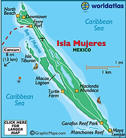
Isla Mujeres (Spanish for “Island of Women”), Mexico is an island only 4 miles long and a bit more than one-half-mile wide located where the Gulf of Mexico and the Caribbean Sea meet, about 8 miles off the coast from Cancún in the State of Quintana Roo, Mexico. Since Isla is the easternmost point of Mexico, the Mexican Navy established a permanent base during World War ll. In 1970 the development of Cancun began and as Cancun grew, so did Isla. Today, Isla Mujeres is the permanent home to about 13,500 residents.
Fun Fact: Even though there is an airstrip on the island, there are no commercial flights. The only way to get to the island is by taking a ferry or boat.
For more information, visit Isla Mujeres Net.

X-CAN, YUCATÁN, MEXICO
X-Can is a town in the Chemax Municipality, Yucatán in Mexico. The town has a population of about 5,191.
Fun Fact: The area contains a number of caves such as Tumben Kuxtal (“new life” in Maya), most of which get discovered accidentally by locals.
For more information, visit X-Can Destination Guide.